About the 3000er in the Pyrenees
The 3000-Metre Peaks of the Pyrenees – High-Alpine Summits Between the Atlantic and the Mediterranean
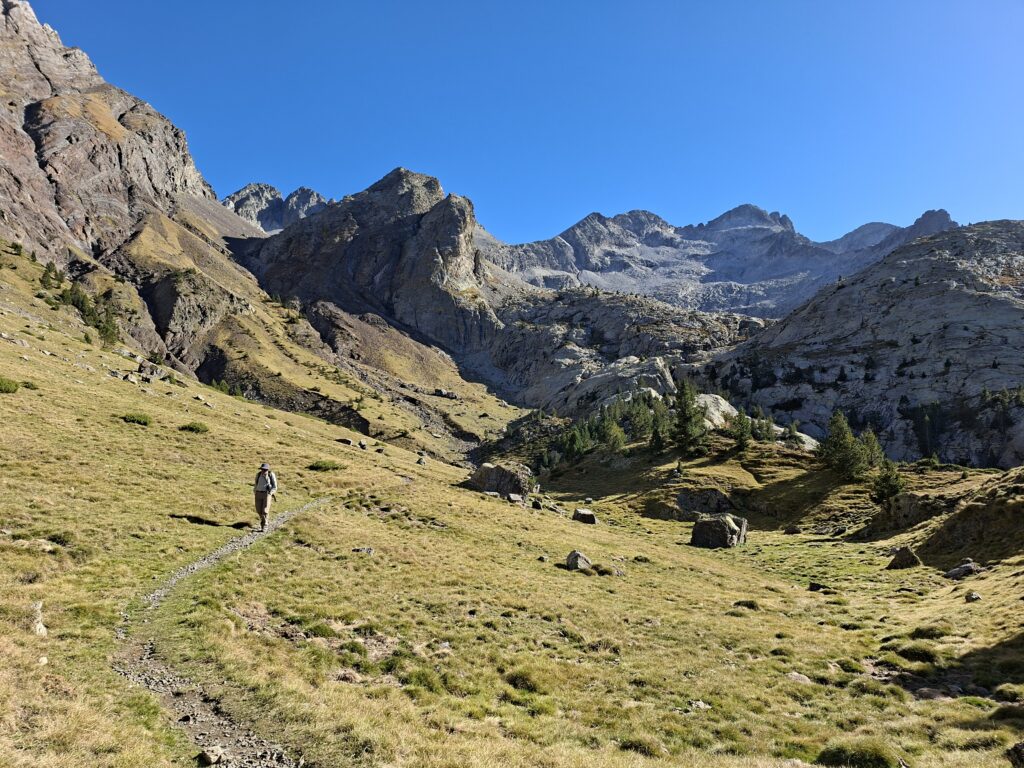
The Pyrenees form the natural border between Spain and France and extend for around 430 kilometres from the Bay of Biscay to the Mediterranean Sea. They were formed approximately 50–70 million years ago by the collision of the Iberian and Eurasian tectonic plates. Compared to the Alps, the Pyrenees are more compact, wilder and less fragmented, characterised by deeply incised valleys and striking high-mountain massifs.
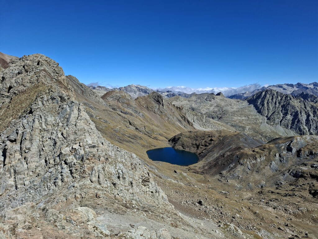
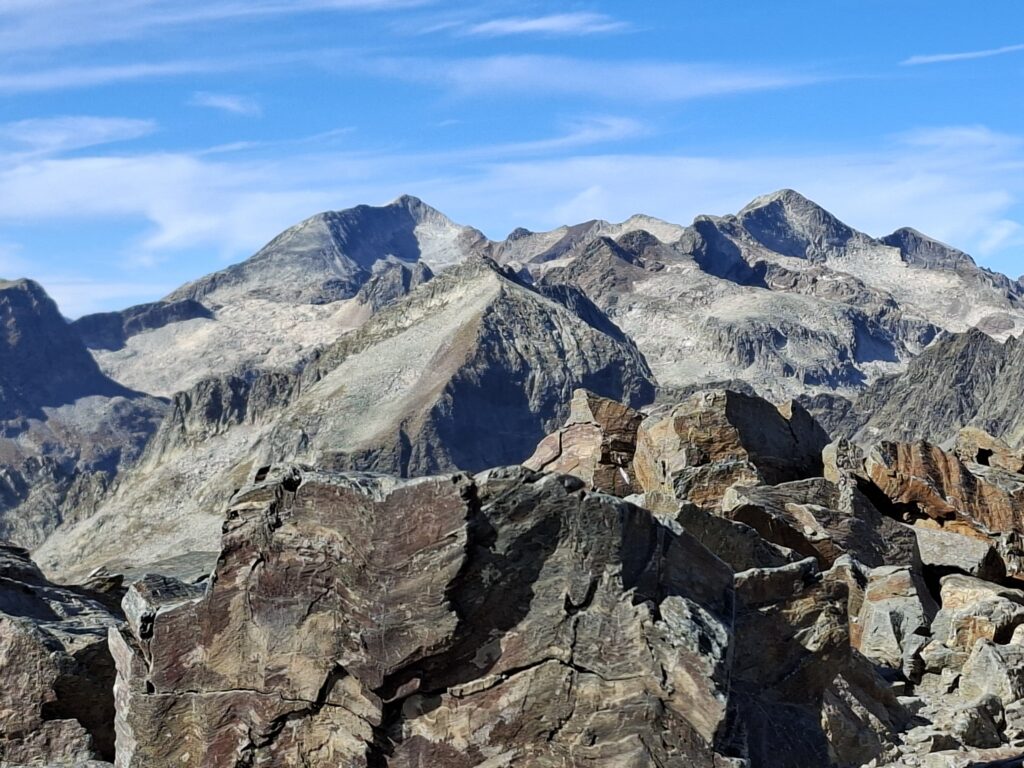
Geographically, the Pyrenees can be broadly divided into the Western, Central and Eastern Pyrenees. The highest and most alpine mountains are clearly located in the Central Pyrenees, particularly along the border between France and Spain. Almost all peaks exceeding 3,000 metres are found in this region.
https://www.suedamerikatours.de/pyrenaeen
General Information About the 3000-Metre Peaks of the Pyrenees
Depending on the definition, there are around 130 to 140 peaks exceeding 3,000 metres in the Pyrenees. If only independent main summits with sufficient topographic prominence are counted, the number is significantly lower. Many of the 3000-metre peaks are part of extended ridges and massif structures, which strongly defines the character of the range.
Typical features of the Pyrenees include:
- Steep north faces (often on the French side)
- Broad high plateaus and lake landscapes on the southern side
- A geological mix of granite, limestone and gneiss
- Glaciated high regions, although the glaciers are rapidly retreating
From an alpinistic perspective, the Pyrenees offer everything from easy high-altitude ascents and long ridge traverses to demanding rock and mixed routes. At the same time, many summits can be reached without glacier travel, making them particularly attractive for mountaineers and ambitious hikers.
The Most Important 3000-Metre Peaks of the Pyrenees (3 Examples)
1. Aneto (3,404 m)
The highest mountain in the Pyrenees is located in the Maladeta Massif in Aragón. The normal route crosses the Aneto Glacier and ends with the famous Puente de Mahoma, an exposed rock passage just below the summit.
Significant as the highest point of the range, spectacular in scenery and varied in alpine character.
2. Posets (3,375 m)
The second-highest peak in the Pyrenees also lies on the Spanish side. Less frequented than Aneto, but equally impressive in terms of landscape. The normal route is long but technically moderate.
A true high-mountain summit with a quieter atmosphere.
https://www.suedamerikatours.de/pyrenaeen/bergsteigerreise-in-die-spanischen-hochpyrenaeen
3. Monte Perdido (3,355 m)
A central summit of the Ordesa y Monte Perdido National Park. Composed of limestone, it stands out geologically from many other Pyrenean peaks.
One of the most important mountains of the range in historical, scenic and geological terms.
The Most Popular 3000-Metre Peaks (3 Examples)
1. Aneto (3,404 m)
As the highest summit, it is the most climbed 3000-metre peak in the Pyrenees. Good hut infrastructure and clearly defined routes make it especially popular.
2. Monte Perdido (3,355 m)
Thanks to its location within a national park and the spectacular valleys of Ordesa and Añisclo, it is one of the most famous mountains in the Pyrenees.
3. Pic du Midi d’Ossau (2,884 m – just below 3,000 m, but iconic)
Although not a true 3000-metre peak, it is one of the most symbolic mountains of the Pyrenees. It is often mentioned alongside the major summits and is extremely popular.
The Most Easily Accessible 3000-Metre Peaks (3 Examples)
1. Taillon (3,144 m)
One of the easiest 3000-metre peaks in the Pyrenees. The normal route from the Refuge des Sarradets is technically straightforward and usually does not require glacier travel.
Ideal for beginners entering the world of 3000-metre summits.
https://www.suedamerikatours.de/pyrenaeen/pyrenaeen-durchquerung-von-frankreich-nach-spanien
2. Pico de la Maladeta (3,312 m)
Less frequented than Aneto, but well accessible via the Maladeta Massif.
A high-alpine ascent that is clear, logical and easy to plan.
3. Pic de Mulleres (3,010 m)
Located directly on the border between Spain and France, with a relatively short ascent from the southern side.
Perfect for a first experience on a 3000-metre peak.
Cordillera Quimsa Cruz – the hidden jewel of Bolivia
Cordillera Quimsa Cruz: Bolivia’s Hidden Mountaineering Paradise
The Cordillera Quimsa Cruz (Aymara/Quechua for “Three Crosses,” also known as Kimsa Krus) is an impressive yet comparatively unknown and remote mountain range in Bolivia. It extends southeast of the Cordillera Real in the Department of La Paz and is a true paradise for mountaineers, climbers, and trekking enthusiasts seeking solitude and unspoiled nature.
General Introduction
The Cordillera Quimsa Cruz is part of the Bolivian Andes and is characterised by its strongly alpine nature. The approximately 30-kilometre-long range is known for its bizarre rock formations, narrow valleys, and predominantly stable granite rock, making it a highly attractive destination for demanding climbing. In contrast to the more famous Cordillera Real, Quimsa Cruz is far less developed for tourism and offers a raw, original mountain experience.
Location: Department of La Paz, Bolivia, southeast of the Illimani Massif
Character: Alpine, glaciated, predominantly granite
Highest Peak: Jacha Collo (also Jachacunocollo), approx. 5,800 m
Mining: Historically—and in some areas still today—shaped by tin mining activities, which ironically often allow easier access via old mining roads
The Most Important Mountains and Peaks
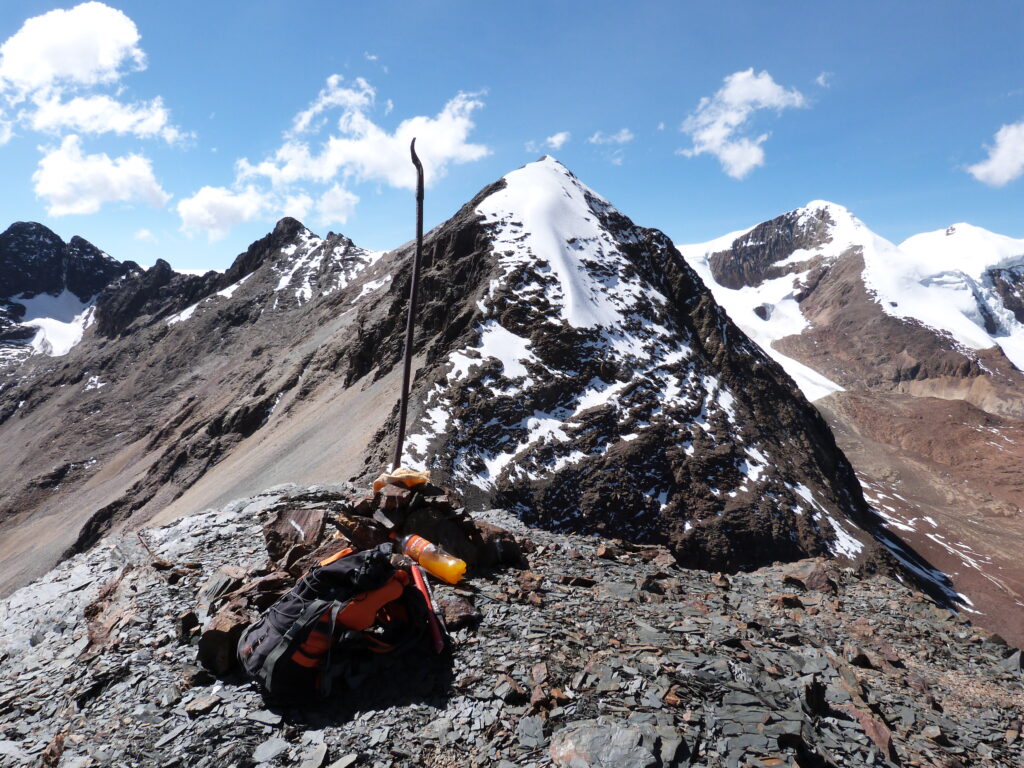
Although the Cordillera Quimsa Cruz does not include any 6,000-metre peaks (the highest summit reaches around 5,800 m), it offers a wide range of technically demanding and scenically impressive high peaks composed of solid granite and ice. Many of these summits are rarely climbed or possibly unclimbed, providing a true expedition-style experience.
Peak Name
Approx. Height
Remarks
Jacha Collo (Jachacunocollo)
~5,800 m
Highest peak of the range
Gigante Grande
~5,748 m
One of the three highest and most striking summits
Cerro Don Luis
~5,754 m
Impressive, often heavily glaciated mountain
León Jiwata
~5,680 m
One of the more challenging ice and rock peaks
Pobre Christo
~5,600 m
Beautifully shaped mountain, a popular objective
Korichuma
~5,500 m
Freestanding, distinctive summit
Cuernos del Diablo
~5,271 m
Important for climbers (granite spires) in the northern sector
Natural Highlights and Special Features
The region is not only of interest to mountaineers but also offers unique natural features that mark the transition from harsh high mountains to subtropical slopes.
Bizarre Rock Formations and Granite Spires
Especially in the northern part of the range, outstanding granite walls and needles form a paradise for rock climbers (e.g. in the area around Cuernos del Diablo or Las Tenazas). The Cordillera Quimsa Cruz is often said to offer the most solid rock in Bolivia.
Glaciers and Mountain Lakes
Despite the general retreat of glaciers, the high valleys are still characterised by glacier remnants and numerous lagoons (mountain lakes), some with striking colours—such as Laguna Congelada near Cerro Don Luis.
Abandoned Mining Settlements
Former intensive tin mining has left behind many abandoned mines and settlements. These ghost towns, where nature is slowly reclaiming human-made structures, create a melancholic yet fascinating atmosphere.
Contrasting Valleys
The valleys are often narrow, with rock faces covered in dark lichens, creating a stark and sometimes oppressive but powerful impression. The eastern side drops steeply into the subtropical Yungas, resulting in higher rainfall and much lusher vegetation at lower elevations.
Valley Settlements and Infrastructure
The Cordillera Quimsa Cruz is generally poorly developed, with very basic and rural infrastructure. Most settlements are small mining villages or indigenous communities.
Settlement
Approx. Height
Role / Infrastructure
Viloco
~3,600 m
Located in the north; considered one of the gateways to the region. Former mining settlement with very limited supplies
Quime
~3,000 m
Situated near the transition to the Yungas; the main town of the region with a more pleasant climate due to its lower elevation
Pongo
~3,700 m
Small settlement that can serve as an important starting point for tours in the main massif
Huaftascota
~4,080 m
Small hamlet (likely mainly used by shepherds) near the Tres Cruces Pass
Infrastructure Notes
Access: Usually via gravel roads from La Paz (approx. 6–8 hours of driving to base camp areas)
Accommodation: No tourist infrastructure such as hotels or mountain huts exists in the high mountains. Overnight stays are typically in tents (base or high camps) or, by arrangement, in very simple local accommodations in mining communities
Supplies: Most supplies must be brought in. Local shops in Viloco or Quime offer only basic necessities
Acclimatisation: Due to the high starting elevations (base camps often above 4,000 m), proper acclimatisation beforehand is essential


Mountaineering, trekking and hiking


Mountain climbing in Marrokos Atalas mountains
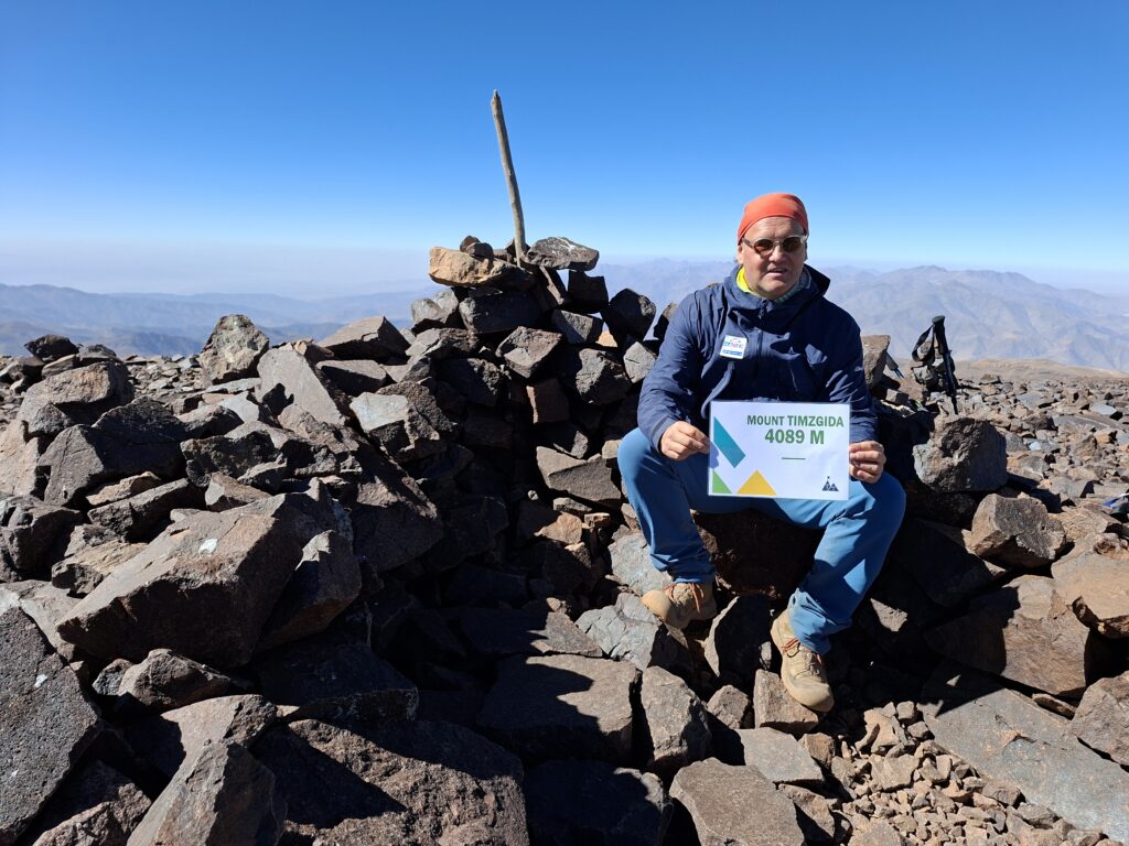
Experience Report: In the Footsteps of the 4,000ers – Ras and Timesguida in the High Atlas
Early in the morning, I leave the narrow streets of Marrakesh behind. In the first light of day, the snow-covered peaks of the High Atlas appear on the horizon—sharp and clear, as if carved directly out of the desert sky. The goal of my journey: the two 4,000-metre peaks Ras (4,083 m) and Timesguida (4,089 m), the quiet neighbours of the famous Toubkal.
From Marrakesh to Imlil – Gateway to the High Atlas
After a drive of just under two hours, I reach the mountain village of Imlil (1,740 m), the starting point for almost all mountain tours in the region. Here I am welcomed by my local mountain guide Hassan, organised through SuedamerikaTours.de. Friendly, calm, and wearing a warm smile, he checks my equipment one last time while, in the background, mules are being loaded.
The small valley is full of life—Berber women in colourful scarves carry firewood, children wave from the fields, and in the clear air there is the scent of mint and earth. Around midday, we set off.
Ascent to the Toubkal Refuge
The trail initially leads gently through the Aït Mizane Valley. Before long, the path becomes steeper and the vegetation sparser. Passing the pilgrimage site of Sidi Chamharouch (2,310 m), with its white rock shrine, we continue upwards. A few tea stalls offer sweet mint tea—a welcome boost of sugar for tired legs.
In the afternoon, we reach the Refuge du Toubkal (3,207 m). Here, at the foot of North Africa’s highest peaks, the first day comes to an end. The air is cool, the evening light golden. In the simple yet cosy hut, mountaineers from all over the world share the tables—Spaniards, French, Moroccans. Stories, laughter, and hot tea fill the room while outside the wind sweeps across the scree slopes.
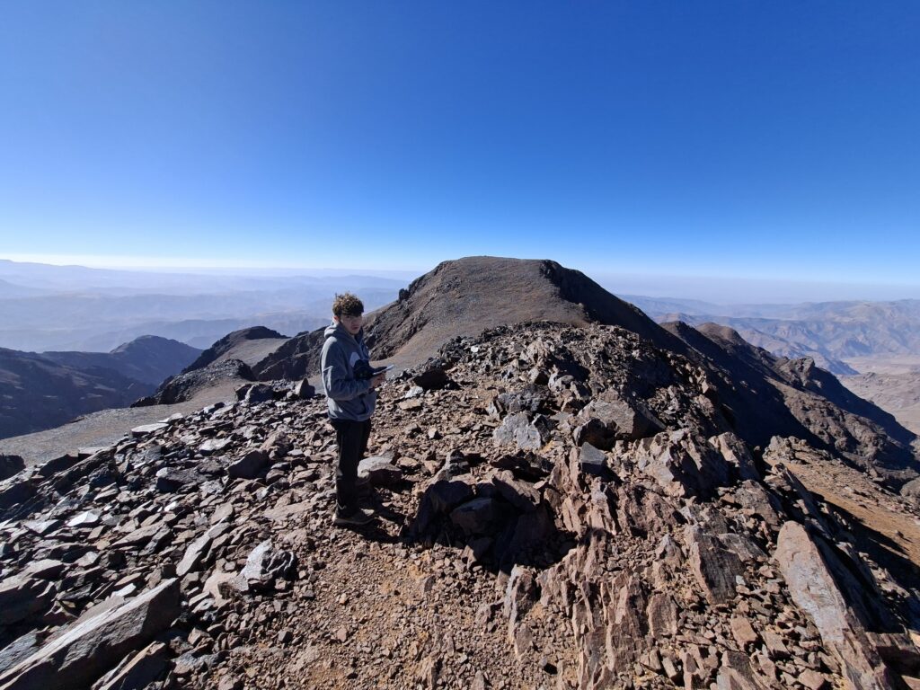
Summit Day – Ras and Timesguida
We set off while it is still dark. The wind is cold, the sky filled with stars. Headlamps dance across the rocky slope, the crunch of stones accompanying every step. We climb a steep gully to the saddle between Toubkal West and Ras. Slowly, the horizon turns orange—the sunrise over the mountains of the Anti-Atlas is breathtaking.
We reach Ras (4,083 m) first—narrow, windswept, and offering a magnificent view across to the dominant Toubkal. Shortly afterwards comes Timesguida (4,089 m), only slightly higher but broader and more comfortable to linger on.
Up here, the world seems to stand still. The Draa Valley to the south fades into haze, while far to the north the plains around Marrakesh shimmer in the distance. Nothing but wind, sun, and the soft clinking of carabiners.
After a short break, we descend the same route back to the hut. In the afternoon, we return to Imlil—tired, dusty, but happy.
Return to Imlil – Berber Life in the Valley
At the small guesthouse in Imlil, hot tea and a tajine with fresh bread await us as a reward. The sun bathes the mountains in warm light, and from the rooftop terrace I look back at the snow-covered peaks, which now seem almost unreal and distant.
What remains is a deep sense of contentment: two summits over 4,000 metres, a piece of the wild Atlas, and the warmth of the Berber people who make this place so special.